⚠️ RED ALERT WINTER STORM BRINGS INTENSE SHORT-DURATION RAINFALL AND FLASH-FLOOD RISK ACROSS CENTRAL AND SOUTHERN ISRAEL
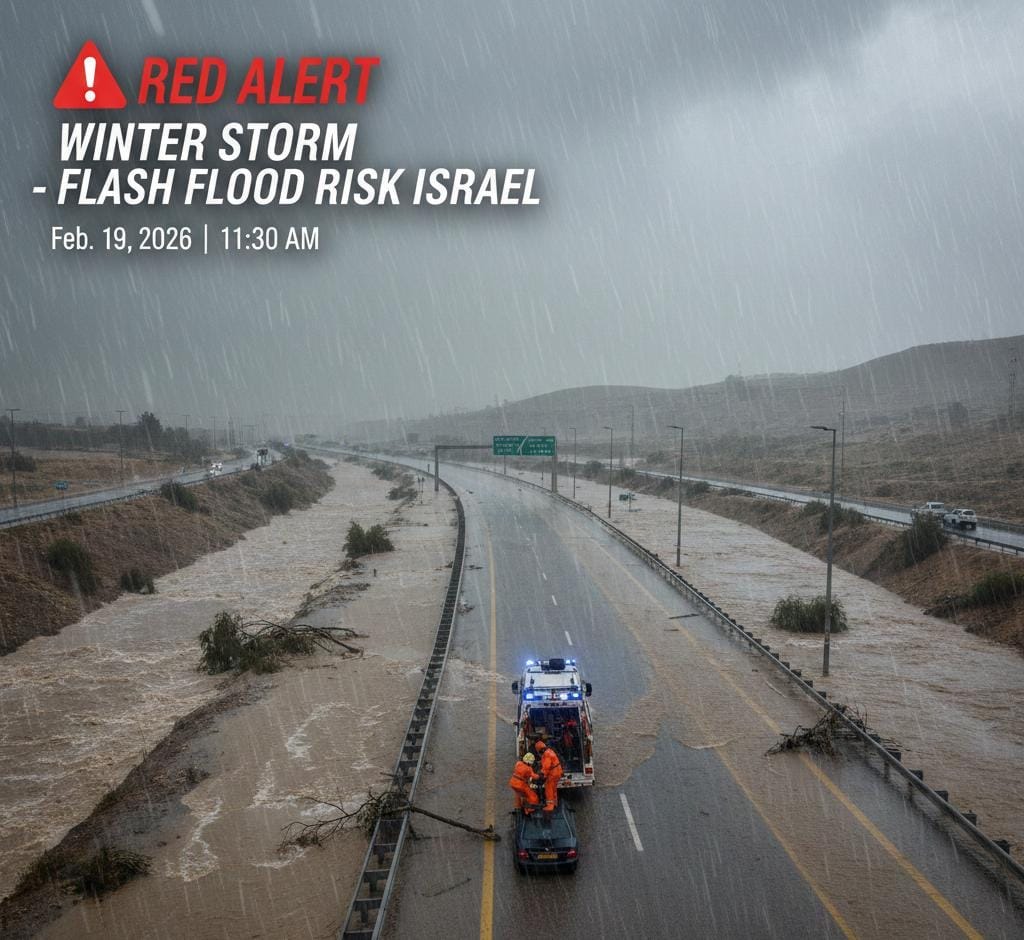
⚠️ Red alert issued for concentrated heavy rainfall across central and southern Israel: Israel’s Meteorological Service warns the system will be brief but severe, with rapid water accumulation, urban flooding risk, and strong runoff in streams across the Sharon and Gush Dan regions, expanding later toward the Jerusalem hills and the south. Dozens of millimeters of rain are forecast within only a few hours, with some locations potentially exceeding 50 mm in 3–6 hours, an intensity described as unusual for the central region in recent years.
❗️ Flooding has already led to rescues in Samaria: Near the Tzofim crossing, two motorists were extracted from vehicles trapped in rising waters. Heavy rainfall is expected through at least midday across the coastal plain and central districts, with urban disruptions possible.
⚠️ Rain band forecast to shift south later today with flash-flood risk continuing into Friday: The storm is expected to move toward the southern coast, western and northern Negev, and the Judean Desert later today and into the evening. Police warn of possible proactive road closures on flood-prone southern routes including Highways 234 (Tze’elim Bridge), 232 (Nahal Shikma), 40 (Nahal Tzihor), and 90 (Ein Gedi to the southern Dead Sea corridor). Rainfall is expected to taper Friday with lingering light showers in central and southern areas, cooler temperatures, and nighttime frost risk in susceptible locations.
⏱️ If this update was helpful, please forward it to family or friends who rely on real-time information from Israel.
🌐 Also available on the web and by email: israelrealtime.com
© Israel Realtime. Independent Israeli security and geopolitical coverage.
Sources credited as available. Connecting the world to Israel — with clarity, responsibility, and context.


